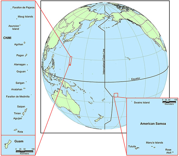
American Samoa, Guam, and the Commonwealth of the Northern Mariana Islands
For more information about the project or additional project publications, visit the Research Project Page
This project began in January 2004 and was completed in January 2005. NCCOS produced a georeferenced, digital atlas of benthic habitat maps for the shallow-water (< 30m) coral ecosystem habitats around the U.S. Pacific Territories of American Samoa, Guam, and Commonwealth of the Northern Mariana Islands (CNMI) The maps support a variety of management applications, including informing resource management decisions, ensuring safe navigation, supporting coastal communities, sustaining coastal habitats and mitigating coastal hazards. For more information about this projects data contact Tim Battista or John Christensen.

Reports
Tools
Data and Maps
Data for Guam, American Samoa, and Commonwealth of the Northern Mariana Islands.
Printable Benthic Habitat Maps for the U.S. Pacific Territories in portable document format (PDF) are available for download below. The maps are grouped by island. Some downloads are zip files containing multiple PDF maps of a specific island. The maps can be printed on paper that is 8.5 by 11 inches or larger.
Guam
American Samoa
CNMI