Buck Island Reef National Monument, St. Croix, U.S. Virgin Islands
For more information about the project or additional project publications, visit the Research Project Page
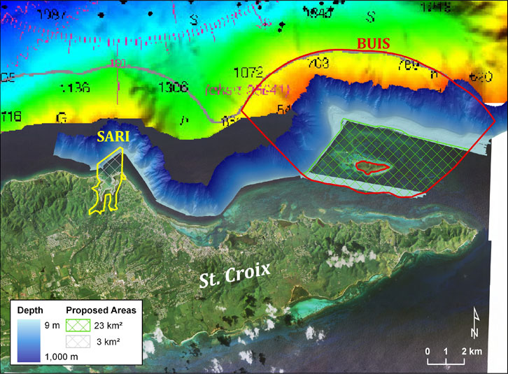
This project began in April 2010 and was completed in January 2012. We developed benthic habitat maps for the Buck Island Reef National Monument, north of St. Croix in the U.S. Virgin Islands. The bathymetry (depth) data we collected was used to update nautical charts in the area, and the related habitat maps we developed are being used by local managers to plan research projects and site-related infrastructure inside the monument, such as placing receivers for the acoustic tracking of fish and sea turtles. For more information about this projects data contact Bryan Costa or Tim Battista.
Reports
Maps and Imagery
GIS Map
Original Imagery
- Orthorectified aerial photo collected using a Leica ADS40 sensor. The image was collected by the USACE, and is in GeoTIFF format (.tif).
- Bathymetry (LiDAR): Image describing the depth (bathymetry) of the seafloor collected using Light Detection and Ranging (LiDAR). The image was collected by Tenix LADS, and is in GeoTIFF format (.tif).
- Bathymetry, Backscatter & Morphometrics (SoNAR): Images describing the depth (bathymetry), physical properties (backscatter) and vertical complexity (morphometrics) of the seafloor collected using Sound Navigation and Ranging (SoNAR). The images were collected and processed by USGS and NOAA, and are in GeoTIFF format (.tif).
Source Imagery
- Water Column Corrected Orthophotos: Orthorectified aerial photos radiometrically corrected for changing water column conditions. These images are in GeoTIFF format (.tif). Used to identify, delineate and classify shallow-water benthic habitats inside BIRNM.
- Relative Reflectivity (LiDAR): Image denoting the relative reflectivity of the seafloor collected using LiDAR. This image is in GeoTIFF (.tif) format, and was used as an ancillary dataset to identify, delineate and classify shallow-water benthic habitats inside BIRNM.
- Principal Component Surfaces (SoNAR): Images describing the vertical complexity of the seafloor derived from the morphometric surfaces. These images are in GeoTIFF (.tif) format, and were used to identify, delineate and classify shallow, moderate and deep-water benthic habitats inside BIRNM.
Benthic Habitat Maps : ESRI shapefiles representing the shallow, moderate and deep-water benthic habitats mapped inside BIRNM.
Ground Validation (GV) Sites: ESRI shapefiles denoting the location of underwater photos and videos collected to produce the BIRNM benthic habitat maps.
Accuracy Assessment (AA) Sites: ESRI shapefiles denoting the location of underwater photos and videos collected to evaluate the thematic accuracy of the BIRNM shallow-water benthic habitat map.