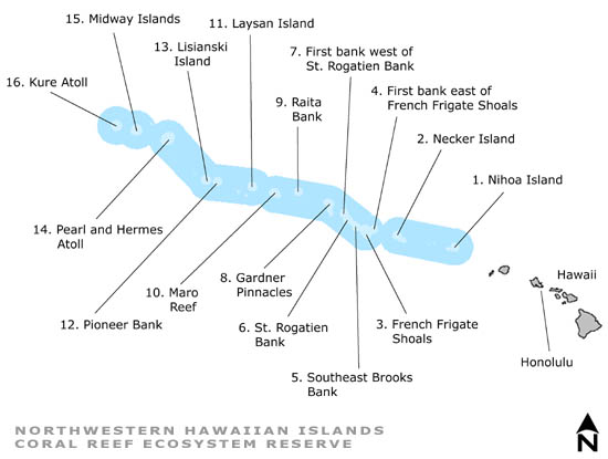
Northwestern Hawaiian Islands
For more information about the project or additional project publications, visit the Research Project Page
This project began in January 2004 and was completed in December 2007. We developed benthic habitat maps for shallow (<30 meters) areas around the main islands of the Republic of Palau to help local managers and researchers develop reef fish management strategies, optimize biological monitoring sampling design, and develop place-based action strategies to address key issues and remedy specific threats to coral reefs. For more information about this projects data contact Steve Rohman, Tim Battista or John Christensen.
Reports
A Marine Biogeographic Assessment of the Northwestern Hawaiian Islands
Data and Maps
Northwestern Hawaiian Islands Atlas
Section 1,
Section 2,
Section 3
Assisted Files and Data for All Islands
Process of map development described in detail
Shapefiles - Arc and PCI legend files for the NWHI maps/shapefiles. When (.avl and .rst extension) added to your Arc or PCI project, these files will cause the vector colors to match the geotiffs.
Map products for NWHI include georeferenced truecolor images derived from IKONOS satellite data, estimated bathymetry (in meters) derived from the imagery, benthic habitat cover, and detailed benthic habitat classes. Files are available for download on the individual atoll pages.